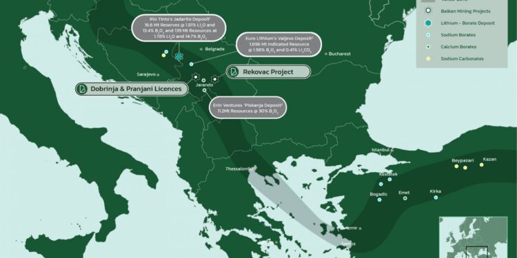
Balkan Mining and Minerals Ltd (ASX: BMM) has received the results of gravity and airborne magnetic survey interpretation over its entire Rekovac project in Serbia.
In conjunction with the field activities, the company engaged a local contractor to process recently acquired geophysics data to assist in outlining potential targets for follow up detail mapping and rock chips sampling over the northern portion of Rekovac project.
The data was analysed in conjunction with a new compilation of gravity data, drill hole information, and outcrop geology. Geophysics interpretation aid in defining basin geometry and identifying deep-seated fault zones within the project area, which may have acted as a potential conduit for mineralising fluids.
Gravity Interpretation Results
The Rekovac basin shape is more elongated demonstrating a distinct NNE trend that parallels the regional tectonic grain of Tertiary arc-extensional structures. Based upon the linear configuration, the parallel sharp gradients on both NW and SE sides and the isolated and deep gravity anomaly it can be inferred that the basin was formed by faulting of basement rock. Th
e symmetrical nature further suggests fairly uniform displacement on both flanks of the basin with a similar history of sedimentary infill from those sides. Since the extension was most active in mid-Tertiary time, this was likely an active Miocene graben, its central low probably the locus of fairly long-lived fine-grained sedimentation.
The Rekovac basin likely contains at least 20 mGal of gravity range representing a thick sedimentary section. The Rekovac gravity anomaly is at least as well confined, rising from -20 mGal in its central low to about +2 mGal at the first mapped basement outcrop, a comparable maximum difference of 22 mGal.
A new estimation of the thickness of Rekovac Neogene Basin (depth to basement) was made based on a new compilation of gravity data, drill hole information, and outcrop geology. This provides a detailed image of the geometry of the basement surface were cut by the fault, and thus an estimate of the vertical offset across the fault, at least since the Neogene sediments were deposited. Drilling data is used explicitly in the inversion to constrain the solution, and the inversion is fully 3-dimensional, thus providing much more detail in the map of sediment thickness and the geometry of the basement surface.
The boratiferous sediment section, which occupies the southwestern rim, likely extends to the northeast into a thick section of restricted-circulation (saline-alkaline lacustrine) sediments in its early Miocene history.
Magnetic Survey Interpretations
The purpose of the airborne magnetic survey interpretation was to gather data that would help identify areas with the presence of “blind” Calc – Alkaline volcanic formations that may serve as a source of the volatile elements. Growth faults are believed to have channelled mineral-rich fluids (brines) to the host strata during basin formation.
The overall magnetic field over the northern portion of the project area has been found to be low to moderately low, with values diminishing to the north of the project area, probably due to the thickening of nonmagnetic younger sediments cover. Within this relative low background, a slightly higher magnetic pattern (10nT above background) may indicate a spring source have been found in the northern central part of the project area. The spring water broadly discharged elevated elements into the lake waters along faulted margins. Those type of subaqueous springs has long been held as a preferred explanation for lithium borate origins.
Drilling update
Managing Director, Ross Cotton, said company is carrying out an internal review of these new and encouraging results in order to prioritise drill sites for follow-up testing. The new data will enable the company to optimise its drilling program and its impact on the potential expansion of drill areas. Therefore, at this stage, the company has decided to defer drilling at the REK_003 whilst sites to the north can be considered and the entire program reviewed and additional access agreements completed. The Company will update the market of progress in due course.
“With 1,800 meters of drilling under contract, the new data has provided ample targets for the full proposed programme to be realised,” Mr Cotton said.
“We believe that additional locations should be included in the programme and all necessary arrangements made with local stakeholders to expedite the program in its entirely.
“Whilst this will add lead time to the breaking of ground at REK_003, we look forward to updating shareholders with developments at Rekovac, Dobrinja and Pranjani as well as new opportunities that may arise.”
For further information please visit: https://balkanmin.com/


