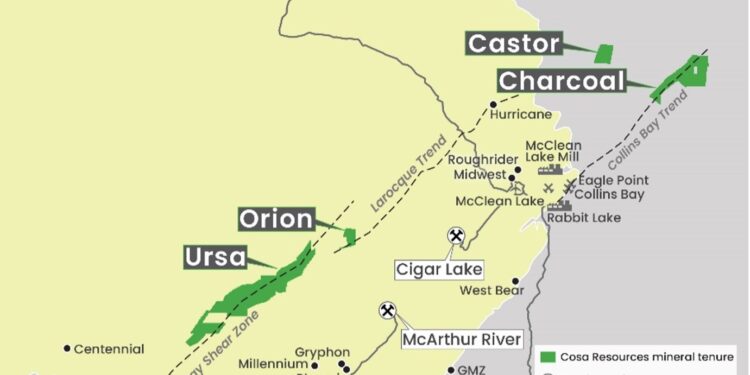
Cosa Resources Corp. (CSE: COSA) has acquired the Helios property covering 12,835ha of prospective uranium exploration ground in the northern Athabasca Basin, Canada. The property was acquired by staking and is wholly-owned by Cosa Resources with no encumbrances.
Highlights
- Target areas include the southern extension of a conductive trend with weak uranium mineralization and over 15km of strike length along a major structural zone.
- Cosa’s wholly-owned uranium exploration portfolio now comprises 100,652ha of highly prospective exploration ground in the Athabasca Basin.
- Low-cost staking has expanded Cosa’s strategically located portfolio to five properties within prospective uranium corridors.
“Similar to our Ursa project, this is an example of our technical team leveraging past experience and discovery success to identify overlooked, cost-effective acquisitions,” President and CEO, Keith Bodnarchuk, said.
“The acquisition cost for Helios was only ~$8,000. With a land package now totalling more than 100,000ha, we continue to create a strong pipeline of projects in the prolific Athabasca Basin.”
Andy Carmichael, VP of Exploration, said that despite containing electromagnetic conductors, a major structural zone, and being located along strike of uranium occurrences, the Helios area has been largely overlooked since the early 1980s.
“As only two historical drill holes have been completed within the property, exploration potential is excellent and we look forward to advancing this early-stage asset.”
The Helios Property
The 12,835ha Helios property was acquired by staking and is wholly-owned by Cosa Resources with no encumbrances. The property is located 14km south of the northern rim of the Athabasca Basin and 28km southwest of the community of Fond du Lac. Provincial winter roads extending from Stony Rapids to Fond du Lac and Uranium City provide ground access to the area.
The broader Helios area was initially explored from 1968 to 1970 and again from 1977 to 1981. Work in the latter period discovered the Ware’s Uranium Occurrence, a zone of outcropping sandstone cut by uranium-bearing fracturing located 6km along strike to the north of Helios.
Limited follow-up drilling in 1979 determined the fracturing penetrates the full thickness of the Athabasca sandstone and drill hole 3991H-03 intersected 0.18% U3O8 over 0.1m within a zone of hydrothermal alteration at the unconformity. Little additional follow-up was completed and minimal modern exploration has been completed throughout the area.
Two initial target areas have been identified on the property. The northern portion of Helios covers the extension of two sub-parallel, curvilinear conductive trends flanking a central magnetic high.
Results from a 2005 airborne electromagnetic survey suggest these conductive trends continue onto the Helios property. The Ware’s Uranium Occurrence is associated with the more westerly of these trends,
A 2007 drill hole testing this trend 4km north of Helios intersected favourable illitic and chloritic clay patterns over broad intervals in the middle to lower sandstone. The depth to the unconformity is expected to be between 375m and 500m within the northern target area.
Within the property, historical electromagnetic and DC-resistivity surveys have defined approximately 5km of basement-hosted electromagnetic conductors associated with the GRSZ with potential for a further 10km extension to the west-southwest. The depth to the unconformity is interpreted to be between 445m and 850m in the southern target area.
For further information please visit: https://cosaresources.ca/


