Data Studies Uncover Overlooked Opportunities At Jackson Property
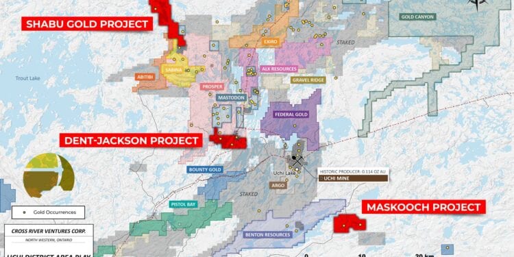
Cross River Ventures Corp.(CSE: CRVC) has identified previously overlooked zones of high-grade gold mineralisation through ongoing data compilation at the Dent-Jackson project, located in the Birch-Uchi greenstone belt, north-western Ontario.
The property’s gold endowment attracted attention goes as far back as 1927, when the Jackson-Manion Consolidated Mines discovered gold along the eastern margin of the claim block which they mined from 1934 to 1940.
The mine produced approximately 27,146 ounces of gold and 18,300 ounces of silver at an average grade of 0.258 ounce/ton Au during several years of operation.
The focus of the mine was gold in quartz veins associated with mafic volcanic rocks. In the 80 years since, the project was explored sporadically, and mineral title changed hands several times. Most of the later work focused on the area around the historic Jackson-Manion mine. However, there are three other gold occurrences on the Dent-Jackson property that remain underexplored.
CEO, Alex Klenman, said theCross River Ventures technical team has identified historic data which documents high-grade trench samples from the Cariboo Vein in the western part of the property, and the East of Little Woman Lake Zone in the central part of the property. Historic diamond drill programs on the property did not adequately test these target areas.
“The Cross River technical team’s detailed data compilation and review is a critical step in the systematic exploration approach we’re pursuing in Ontario,” Mr Klenman said.
“These findings highlight important facts about the geology and potential gold endowments within the claim blocks and provide essential guidance for targeting in the months ahead.
“The exploration strategy is to advance all of the company projects to drill-ready status, using a data driven approach that results in optimal target generation.
“When we drill, we want to be sure we’re putting those holes down in the best possible places for meaningful discovery.:
Mr Klenman said ongoing geological interpretations of the claim block will focus on interpreting the regional structural framework which will allow for a predictive model of shear zone geometry in plan and 3D.
Acquisition of LIDAR data in Q2 will aid in the structural reconstruction and provide a baseline tool for field crews to use during the Summer 2021 ground assessment of the claim block. The Company is hoping to generate quality drill targets for testing later in 2021.
The Cross River technical team is currently completing data reviews on all of its projects in NW Ontario and expects to complete the reviews prior to Q2 2021.


