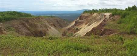
Western Alaska Minerals Corp. (TSXV:WAM) has received updated interpretations of geological, geochemical, and geophysical surveys, which combined, indicate multiple high-potential carbonate replacement deposit (CRD) and porphyry copper-gold drill targets on the 100%-owned Illinois Creek property in Alaska, USA.
Highlights
“East Block”
- Geophysics (IP and CSAMT) and soil geochemistry reveal several robust overlapping anomalies that coincide closely with the high-grade silver-lead-zinc CRD mineralization discovered in 2022.
- IP geophysics indicates an offset of the Waterpump Creek CRD mineralization but continuing 1.4 kms to the south across the Illinois fault. This look-alike anomaly is over three times longer than the current known Waterpump Creek sulphide body. The anomaly continues to the limits of the IP survey.
“West Block”
- Several large-scale new targets have been developed, including an approximately four x two km target dubbed the “Warm Springs” CRD target. This target is in untested carbonate stratigraphy permissive for mineralization adjacent to historically mined Au/Ag gossans.
- The Warm Springs CRD target extends to the west into a major coincident copper-gold soil anomaly lying south of the historical Illinois Creek gold oxide mine. This 1.5 x 1.5 km target could represent the porphyry-related mineralizing fluid source for the property.
“Our rapidly growing data sets have defined some very exciting targets for our upcoming program,” said Kit Marrs, Western Alaska’s President and CEO. “I would like to acknowledge our technical team for their excellence in compiling and reinterpreting our historical and new data. We are eager to get back on the ground and get the rigs turning”.
Execution Plans
The company is having additional drilling rigs built for fast-track testing of the numerous targets emerging from the updated exploration model. Current plans are to drill up to 17,000m in 2023, deploying up to four rigs to both expand the Waterpump Creek mineralization discovered in 2022 and begin testing the property wide CRD exploration targets.
A modern 3D IP/resistivity geophysical survey is planned to: 1) Confirm and improve resolution of the reinterpreted Waterpump Creek/Last Hurrah sulphide anomaly; and 2) Define additional anomalies over a 3 x 6 km area of the East Block north and south of the Waterpump Creek discovery.
A district-wide helicopter-borne geophysical survey to further the understanding of the geologic framework of the East and West Blocks, and to define additional targets including copper-gold porphyry/skarn deposits is also being planned.
For further information please visit: https://westernalaskaminerals.com/


