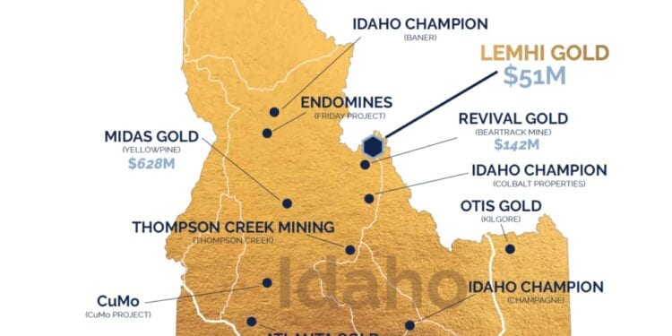
New Targets Proximal To Lemhi Gold Project Resource
Freeman Gold Corp. (CSE: FMAN) (OTCQB: FMANF) has defined 11 high priority target areas for follow-up exploration on its 100% owned Lemhi Gold Project located in Idaho.
The new targets have been identified via the 2020 field season that included the collection of a total of 633 soil samples were collected along with 145 rock grab and channel samples.
Comprehensive geophysical surveys were completed, consisting of 565 line km of ground magnetics covering almost the entire property and 1.4 sq, km of 3D IP Data over the known mineralised zone.
In addition, historical data compilation and interpretation were finalised and incorporated into the exploration data base. The results of the surface exploration campaign have demonstrated the prospective nature of Freeman’s land package.
President and CEO, Will Randall, said none of the new targets have been drill tested to date.
“The exploration results demonstrate that targets both in close proximity and further afield from the known Lemhi mineralised gold oxide zone exist throughout the property,” Mr Randall said.
“Since Freeman is the first company to have a large consolidated land package along the major northeast structure, we feel confident we are on the right track to make additional gold discoveries.”
Prospecting and sampling was completed over the entire Lemhi property. Of the 145 rock grab samples collected 54 returned assay values greater than 1 gram per tonne gold (g/t Au) and 20 greater than 5 g/t Au (up to 450 g/t Au). Of the 145 rock grab samples collected 27 samples contain greater than 10 grams per tonne Silver (g/t Ag), with values up to 219 g/t Ag. These results have identified five new exploration target areas for priority follow-up. Follow-up exploration at each of the target areas will include but not be limited to prospecting, mapping, soil sampling and possibly drilling.
During 2020, ground magnetics were collected over the entire Lemhi Property using GEM Overhauser walking magnetometers with DGPS. The regional grid was completed at 25m line spacing, and the known mineralised area was completed at 12.5m line spacing, totalling approximately 565 line km of magnetics.
The survey was successful in identifying the boundary between the intrusion(s) and the Proterozoic meta-sediments, following clear extensions of the known gold mineralisation at Lemhi. In addition, this boundary or contact has been mapped for seven km along a major northeast trending structure that follows the direction of important regional structures. The survey has also shown secondary west-northwest structures that intersect these major lineaments and boundaries. One such intersection occurs in the area where known gold mineralization has been defined by over 70,000m of drilling, while a second intersection has been interpreted 1.7 km along strike and northeast of the known mineralisation, such that is exhibits structural similarities to the known mineralisation
A Dias Geophysical Limited 3D Induced Polarisation (3D IP) was carried out during September and October of 2020. The survey area consisted of a 1.4 km X 1.4 km area centred over the area with known mineralisation, which extends roughly 650 meters east-west by 500m north-south. The survey was designed to characterise the geophysical signature of the deposit and possibly define new areas of gold mineralisation and extensions of the known mineralised zones delineated by drilling.
Two major contacts have been interpreted. The strongest one follows an east-northeast curvi-linear trend where chargeabilities are generally low and resistivities are very low to the south-southeast. This contact is also coincident with a magnetic high trend. The second major contact trends north-south, located on the west side of the survey block and is characterized by low chargeability coincident with low resistivity.


