Hires Consultant For Drill Permit In Utah
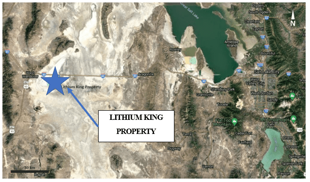
Global Battery Metals Ltd. (TSXV: GBML) (OTCQB: REZZF) has renewed leases on 88 claims covering a total area of 1,760 acres on its Lithium King property in Utah, USA.
The claims cover geologically significant features such as basement high and local graben fault structures believed to allow up-flow of lithium bearing fluids from deeper basinal brines.
President and CEO, E Michael Murphy, said early exploration was conducted by covering the claim area with ground magnetic and gravity surveys.
Work completed since project acquisition in March 2021 has identified ideal locations for initial well test drill holes.
The company has now hired McKay Mineral Exploration, LLC to assist in the drill permit application.
“Our work to date on the Lithium King property continues to support our thesis of the potential for the discovery of a significant lithium bearing brine aquifer,” Mr Murphy said.
“Our work will focus on a key fault structure that is interpreted to allow up-flow of lithium bearing fluids. With the engagement of McKay Minerals Exploration, LLC, we look forward obtaining a drill permit before year end.”
Lithium King Property
The Lithium King property was identified by the company in 2020 and the project area was staked in the first quarter of 2021.
Historical Lithium values from 39 shallow USGS wells (25 feet) averaged 244 parts per million (ppm) and ranged from a low 49 ppm to a high of 1,200 ppm. The Lithium King property is within the Great Basin of the Western United States, where lithium concentrations of greater than 10 ppm in brines are anomalous. Lithium values from the only lithium production in the United States, in Clayton Valley, Nevada, also in the Great Basin, range from 75 to about 250 ppm.
Magnesium values at the property and near vicinity range between 1,300 and 8,500 ppm.
The shallow aquifer water samples may not reflect the deeper basin below 25 feet depth. Drilling to bedrock and brine sampling is needed to confirm the presence of and concentration of lithium in the deeper basin brines.
Based on the geophysical surveys and historical data, the area underlying the claims are interpreted to be part of a regional basement high with local graben structures. This structural setting is believed to represent a conduit for basinal brine up-flow.
Earlier this year, 32-line km, over four lines, of ground magnetic was acquired over the claim package and basement/basin boundary. The same lines were then surveyed using ground gravity. The work was done by Quantec, and the results were inverted in 2D sections to help with basin interpretation and test well targeting.
Based on this work, four initial test well targets have been identified within the claim block.
For further information please visit: https://www.gbml.ca/


