Major Exploration Programme Planned For NT IOCG Project
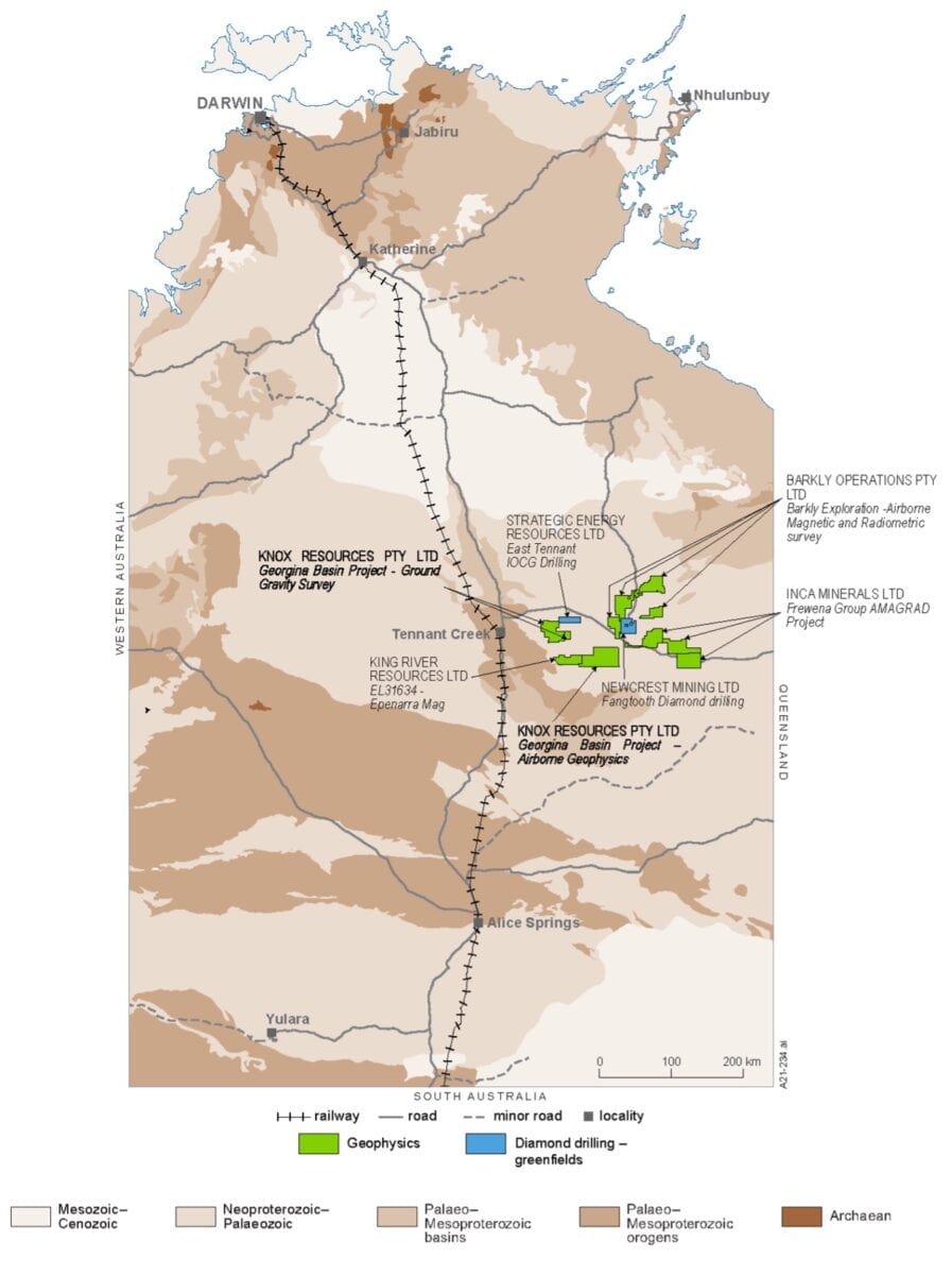
Greenvale Mining Limited (ASX: GRV) is set to commence a multi-pronged, high-impact exploration programme at its Georgina Basin IOCG Project, located in the emerging East Tennant region of the Northern Territory.
The company was a first-mover in this district, which has recently emerged as one of Australia’s most prominent new exploration frontiers following the exciting results of Government- funded drilling programs under the National Drilling Initiative (NDI).
As it gears up to further evaluate several large exploration targets identified on its tenements, the company also revealed that its wholly-owned subsidiary, Knox Resources Pty Ltd, has been successful in two applications submitted to the Northern Territory Government, under the Northern Territory Geophysics and Drilling Collaborations Program (Round 14).
The grants are funded under the Resourcing the Territory initiative with the objective of increasing the intensity of exploration drilling and geophysics in under-explored areas of the Northern Territory. The Northern Territory Geological Survey (NTGS) oversees the grants program, which awards around $1 million in exploration grants annually, distributed amongst several successful applicants.
The company said the grants provide increased confidence in the East Tennant province and further reinforce the NT Government’s commitment to transforming this area into Australia’s next Tier-1 exploration and mining precinct.
The funds will be utilised in the company’s upcoming works programme, which will continue to build on the geological knowledge already obtained for the north-western and central tenement groups with continued airborne geophysics and comprehensive ground gravity surveys.
As part of the upcoming work programme, GRV’s north-western tenements (EL32282 and EL32296) will undergo a significant ground gravity survey aimed at considerably enhancing the quality of information around several drill-ready targets identified through previous airborne geophysics.
The addition of detailed gravity data, including targeted higher resolution line data, across the tenements will further assist in understanding important structural corridors, the distribution and architecture of prospective geological horizons and potential fluid sources, while also providing greater confidence in drill targeting across the project area.
Due to the extensive cover in GRV’s project area, geophysical tools such as magnetics and gravity remain critical for understanding key mineral systems elements and target vectoring.
Of particular interest are two priority bullseye magnetic targetslocated along a major fault corridor, identified during the company’s previous airborne geophysical survey.
Geophysical inverse modelling suggests that the targets lie at a depth of approximately 300m below surface. The detailed gravity program will allow for more accurate drill targeting of these anomalies on commencement of drilling, scheduled for August this year.
Current ground gravity coverage within EL32282 is relatively sparse, with the majority of the tenement only covered by gravity data acquired using a 4km x 4km station spacing. Improving the resolution of the ground gravity data will assist in interpreting stratigraphic units and structures within the project area, particularly in areas that are magnetically quiet and, in EL32282, where only sparse 4km spaced gravity data is currently available.
The upcoming programme will improve the resolution of data within EL32282 and EL32296 by acquiring more gravity data using a station spacing of 1km x 1km, resulting in a total of 911 gravity stations in the project area.


