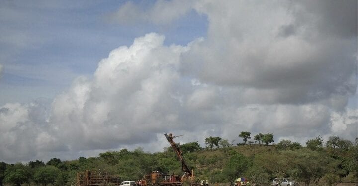
Targeting Near Term Exploration Campaign In Mali
Panthera Resources Plc (AIM: PAT) has revealed announce plans to recommence fieldwork at its Bassala Project located in southwestern Mali, approximately 200km south of the capital city Bamako.
Following the end of the wet season and the easing of COVID-19 restrictions, an initial field visit to the Bassala site is currently in progress to assess the current access situation and to obtain clearance from local officials to start the detailed work programme on or about the end of October.
A programme of extensional soil sampling and regolith mapping is proposed to start in late October and to be concluded by early December.
In conjunction with the work programme, a ground magnetic survey has been commissioned to cover the entire tenement area using local geophysical contractor EurekaGeo Geoscientist Consultants (EGC). This programme is due to commence in early November and is expected to complete within that month.
These work programmes aim is to define and rank drill targets for a drilling programme which is expected to commence in the first half of 2021.
The Bassala project is located within a highly gold endowed Birimian volcano-sedimentary belt that hosts the Kalana (Endeavour Mining, 4Moz) and Kodieran (Wassoul’or, 2Moz) gold mines, both within 5-8km of the licence area.
The adjacent belt to the west is also well endowed with gold and hosts the Siguiri (AngloGold Ashanti (“AngloGold”), 17Moz), Tri-K (Avocet Mining, 3Moz), Kobada (African Gold Group, 3Moz), and Yanfolila (Hummingbird Resources, 2Moz) gold mines.
Whilst the licence hosts prolific artisanal mining activity, the only significant previous systematic exploration was undertaken by AngloGold during the period 2010-2011. That work consisted of broad spaced soil sampling at 800m x 100m spacing with limited infill to 400m x 50m and 200m x 50m spacing in selected areas. It identified several gold in soil anomalies but it was difficult to interpret major trends due to the broad sample spacing.
The surface sampling campaign was followed up by selective shallow trenching designed to investigate beneath the laterite cover. That work was unsuccessful due to the thickness of the laterite.
AngloGold subsequently decided to undertake broad spaced RAB drilling over the main soil anomalies and a total of 3,111m was completed in 113 holes at an average depth of 27.5m. That work was very successful and identified significant mineralisation beneath the laterite cover, including:
- 21m @ 1.15g/t Au from 15m including 3m @ 4.52g/t Au from 33m
- 15m @ 0.56g/t Au from 3m to the end of the hole
- 3m @ 0.78g/t Au from 21m to the end of the hole
- 6m @ 0.49g/t Au from 39m to the end of the hole
- 3m @ 1.55g/t Au from 9m
- 3m @ 1.16g/t Au from surface
Several RAB drill holes ended in gold mineralisation, suggesting potential for significant bedrock mineralisation beneath these shallow gold intercepts.
Work conducted to date by Panthera has consisted of systematic soil sampling at 200m x 100m spacing and combined with detailed regolith mapping. This more detailed sampling has resulted in a much better definition of gold mineralisation trends, especially when interpreted in light of the regolith mapping.
The company said it is now apparent that the main trend is roughly north-south with the only significant gaps in the anomalous trend being due to depositional regimes associated with recent alluvium that mask any underlying gold mineralisation.
There are numerous artisanal workings support the almost north-south trend
Artisanal miners have recently obtained some coarse angular gold from these workings suggesting it is close to the original bedrock source. This recent work, when combined with the previous AngloGold RAB drilling, defines a large gold target in excess of 9km long in an almost north-south direction and within 8-10km of two operating gold mines with gold endowments of 2Moz and 4Moz respectively.


