Drone Magnetics And Induced Polarisation Survey Completed
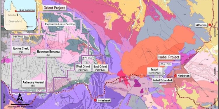
Red River Resources Limited (ASX: RVR) has successfully identified multiple large silver indium targets through drone magnetic and induced polarisation (IP) geophysical surveys undertaken on its Orient project near Herberton in North Queensland.
The company completed a 14 sq. km2= drone magnetic survey and six lines of IP (Induced Polarisation) geophysical surveying at the Orient mining camp on licence EPM 27223.
The magnetic survey and three of the lines of IP survey completed in May 2021, were completed using a Queensland Geological Survey Collaborative Exploration Initiative (CEI) grant awarded to Red River in August 2020. The results from the first three lines of IP encouraged Red River to complete three additional lines of IP to achieve complete coverage across the entire Orient mining camp area.
The surveys aimed to map and target mineralised structures additional to those already known within the Orient tenement and aid in improved targeting for exploration drilling.
The Orient silver-indium project comprises the Orient West and East silver-lead-zinc-indium deposits and is highly prospective for additional high-grade deposits along strike and down dip.
It was one of two polymetallic projects granted to Red River last year that host the highest grade known indium deposits in Australia. Indium is a new economy mineral used in electronics and has been identified as a critical mineral by Geoscience Australia.
Red River’s drone magnetic survey provided high density and quality data over a 14 sq. km area covering the Orient mining area and surrounds. The magnetic data clearly highlights the northeast trend of the known mineralisation at Orient West which continues for a further 1.6km to the east indicating the potential for additional mineralisation.
At the Orient East and Nannum workings the structural setting from the magnetic data appears more complex indicating the potential for stockwork style veining (Figure 2).
The survey also identified a large elongated magnetic feature to the south of the Orient West workings which appears to be fault bounded within the Bluewater Rhyolite. The feature contains several deep lows that may represent a buried intrusion complex.
The IP survey was designed to test the response of known mineralised areas at Orient East and West and to further target additional possible mineralisation along strike, inclusive of areas associated with the magnetic features identified in the drone magnetic survey.
Three lines totalling 7.18 line km were completed under the CEI grant and a further three lines totalling 5.3 line km were completed. Results show conductors and chargeability features coincident with and along strike of known mineralisation and a large, buried IP feature associated with the margins of the magnetic low feature identified in the drone magnetic survey.
Overall, the two techniques were successful in identifying the structures and IP responses of known mineralisation and extensions to the structures that will be further assessed for additional mineralisation. The magnetic feature in the Bluewater Rhyolite and corresponding IP chargeability features are a new target style for the area.
For further information please visit: http://redriverresources.com.au/


