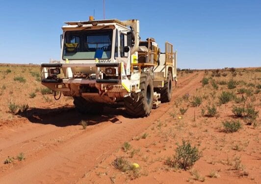
2D Survey Shows 1.5km Depth Continuity At HN9
Magnetic Resources (ASX:MAU) has identified new structures with the study of results from the processing of a 2D shallow seismic on an 8km long EW line at its HN9 gold project in Western Australia.
Completed in December, the 2D was centred on HN9 and extended eastwards to Lady Julie. It has shown up multiple stacked east-dipping thrust structures that correlate with the shallow easterly dips of the mineralisation at HN9 (20 deg) and Lady Julie (45 deg), that extend down to 1.5 to 2km depth at HN9 and 1km at Lady Julie.
Importantly, the surface gold mineralisation at HN9 and Lady Julie correlate with individual thrusts that persist and continue down to great depths. These thrusts will be targeted in our deeper drilling programmes planned.
The HN9 2km-wide thrust zone contains six individual thrusts which come close to surface. These thrusts are all prospective for HN9 type deposits which are 3km long by 200m wide and each new thrust will be investigated, especially the thrusts that come close to surface. This domain is very distinct and is underlain by a separate domain with flat lying reflectors to the west. The Lady Julie thrust zone is 500m wide and has three persistent thrusts that go down to a 1km depth.
Magnetic has generated new targets, mainly from persistent individual thrusts that continue to surface especially as part of larger thrust packages. One of these has a correlation with and may extend through the Wheel of Fortune (WOF) anomalous soil geochemistry and further northwards to the anomalous soil geochemistry on the western part of HN5. This interpretation will be further assessed once the passive seismic results are processed and interpreted.
The final interpretation of the shallow seismic results will assist in planning deeper drilling programmes below the current drilling average depth of 55m down to a 400m depth. Some of the larger gold deposits in the region have large depth extents, sometimes greater than 1km.
The 2D seismic interpretation completed so far covers the 8km EW line centred on the HN9 and Lady Julie areas and the next interpretation will cover the 8km NS line. This will be followed by the interpretation of a large passive seismic survey, which covers a 30 sq. km area centred on HN9. In addition, reprocessing of a 27km and 25km section of the Geoscience Australia 2D seismic lines data on the Old Laverton road and through the Wallaby Deposit area.
The aim of these surveys is to focus on imaging the deep-seated structure of both HN9, Lady Julie, HN5 and HN3 areas and tie it in with the regional architecture that hosts the Wallaby and Granny Smith Deposits. The lines have been selected and positioned to optimally image the sub-surface structure geology and structure based on the current data.
The data quality of the 2D seismic survey was very good. During the acquisition of the two 2D seismic lines additional nodes were laid out on a regular 250x250m grid pattern to acquire passive seismic data over an area centred on HN9. This passive array is being utilised to show a 3D effect and help with future deeper drill hole location.
This shallow seismic survey will tie into the 27km seismic survey completed previously by Geoscience Australia along the Old Laverton Rd and will allow better interpretation by providing a framework for the gold intersections made by Magnetic Resources in the previously drilled HN3 and HN5 prospects and for the search for new mineralised thrust domains, multiple thickened lodes and other targets.


