Results Define Extensive Gold Anomalies In Côte d’Ivoire
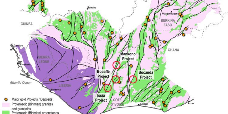
Tanga Resources Limited (ASX: TRL) has successfully completed its regional exploration programmes over the Mankono Ouest permit, which forms part of the Mankono Project in Côte d’Ivoire.
From these programmes, the company has revealed two extensive gold anomalies of +9km that correlate with a prospective structural framework and favourable host rocks to accommodate significant gold mineralisation.
A further series of smaller one to two km long gold anomalies are also well defined and warrant additional work.
Chairman, Andrew Pardey, said follow-up exploration programmes on both of these major anomalies is now underway.
“The systematic approach we have adopted with our exploration programmes is to ensure the geology and geochemistry on the permits are well defined to clearly identify the real potential for gold mineralisation on the Project areas,” Mr Pardey said.
These results, together with previously reported results, support the approach being taken by Tanga.” Mankono Ouest permit update The Mankono Ouest permit covers 379 sq. km of prospective ground, located on the western side of the Banfora-Daloa greenstone belt, on the regional shear system that hosts the Abujar gold Project along strike to the south and the Napié gold Project along strike to the north.
The Mankono Ouest permit and the Mankono and Teningboué permits (both of which are currently under application) comprise the Mankono Gold Project.
The permit area has previously seen limited historical exploration showing the presence of gold but was unable to identify the in-situ host.
Tanga has initiated a systematic and unbiased field exploration approach, including termite mound sampling and regolith and geological mapping. Results and interpretations of this work have now revealed a new set of gold anomalies in their structural and lithological framework, and better defined the “central gold anomaly”, which correlates with the historical gold in soil anomaly.
A total of 2,595 regional termite mound samples were collected over a 400m grid, covering all the Mankono Ouest permit. The samples have been analysed using a standard 50g gold fire assay with an atomic absorption finish and all results have been received.
Multi-element soil geochemistry is also being collected using a four-acid digest with ICP-AES and ICP-MS finish; the last batch of results is still pending, corresponding to the northern third of the permit.
Gold assay results returned a very coherent anomaly on the permit, with two major +9km length, 4 – five km wide anomalies identified; the central gold anomaly and southern gold anomaly.
A series of smaller one to two km long anomalies, which can be outlined by a +15ppb envelope, were also identified.
Multi-element assay results, coupled with regolith and geological mapping and the detailed magnetic and radiometric imagery, led to the solid geology interpretation and to the structural framework interpretation at the permit scale with both of the main gold anomalies fitting well within this framework.
Final results from work carried out at the north of the Mankono Ouest permit are pending.
The southern gold anomaly – which is new and not previously covered by historical sampling – is controlled by two NNE-SSW trending regional shear zones and lies over a mafic unit, represented by basalts and gabbros and an intermediate volcanic and quartzite unit.
Part of the gold anomaly also correlates well with high arsenic, antimony and silver values.
Gabbros and basalts represent excellent host rocks for orogenic gold systems; therefore, due to the favourable host lithologies, this anomaly is considered significant and will be the main focus for immediate follow-up work.
The central gold anomaly – which correlates well with the historical main gold in soil anomaly – lies over higher-grade metamorphic rocks, gneiss, granitoids and other migmatites. The high-grade core of the anomaly, which is well above 50ppb, is directly controlled on its western side by a NNE-SSW shear, coherent with all of the regional structural orientations.
This control plays an important role for potential in situ mineralisation and will be further tested with auger drilling.
Regolith mapping has highlighted the complexity of the weathering profiles over the majority of the permit, with several levels of thick ferricrete and a regular surface cover of lateritic colluviums.
The vegetation over the area is quite sparse and the land is largely cultivated, as a result, most of the surface soils are unrepresentative of the underlying gold anomalism, hence the use of the termite mounds as a proven and efficient sampling method.
Follow-up programmes will include an infill termite mound sampling grid over the regional southern gold anomaly, and later over the series of smaller gold anomalies located on the permit. An auger drilling program is also planned, which will test the main structures (in the central gold anomaly and on the detailed anomalies after the infill gold results have been returned). The infill termite mound sampling programme is currently under way.
For further information please visit: https://www.tangaresources.com.au/


