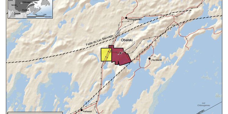
TomaGold Corporation (TSXV: LOT) (OTCQB: TOGOF) is undertaking an extensive gyroscopic survey programme on historic drill holes that are more than 100 metres deep and accessible on its wholly-owned Obalski property, located three km south of Chibougamau.
The surveys will be conducted by Géophysique TMC of Val-d’Or. The objective of these surveys will be to confirm the location of Obalski’s historical gold-bearing structures at depth.
“The results of the Pulse-EM survey, combined with Corem’s analysis of some historical samples, have established that the Obalski property is mainly composed of gold-bearing vein structures and that these structures appear to amplify at depth in the form of veinlets,” President and CEO, David Grondin, said.
“Furthermore, there is a strong possibility that the structures at depth were not properly located, mainly due to the drilling equipment used at the time. Since this property has been explored mainly at surface, we must ensure that our drilling campaign is well oriented, as our main objective is to better understand the mineral potential of Obalski at depth.”
The Corporation previously obtained excellent drill results from its 2,502-metre winter 2020–2021 program, with several high-grade gold and copper values, including 47.4 g/t Au, 87.6 g/t Ag and 7.06% Cu over 1.1 metres and 67.1 g/t Au, 40.1 g/t Ag and 2.32% Cu over 0.5 metres in hole OBS-20-002; 12.45 g/t Au, 17.7 g/t Ag and 0.53% Cu over 0.65 metres in hole OBS-20-001; and 23.7 g/t Au and 24.5 g/t Ag over 0.5 metres in hole OBS-21-005.
The Obalski property covers 345 hectares, lies about 2 km south of Chibougamau, Quebec. Discovered in 1928, the Obalski deposit produced 100,273 tonnes at grades of 1.14% Cu, 2.08 g/t Au and 6.04 g/t Ag from the A zone between 1964 to 1972, and around 9,000 tonnes at a reported grade of 8.5 g/t Au from the D zone in 1984
For further information please visit: https://www.tomagoldcorp.com/en/


